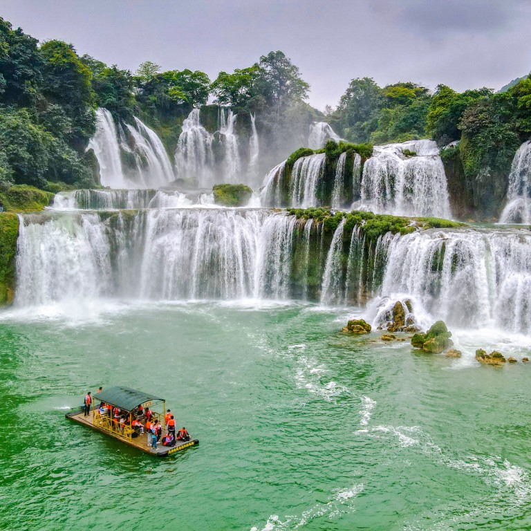
The world’s most Instagrammable border crossings, the only zip line that crosses a frontier, and the countries divided by waterfalls
- From Niagara Falls to the jagged peaks of Zakopane, Poland, to Patagonia, many international borders are in areas of outstanding natural beauty
- There’s only one frontier you can traverse by zip line – that between Spain and Portugal – don’t worry, you won’t need to show a passport as you whizz across
International borders are often in areas of outstanding beauty, which is hardly surprising when you consider how many are defined by natural features.
Rivers make up 23 per cent of all frontiers and snow-capped mountain ranges are another effective way of separating nation states. Deserts also play a demarcating role, as do lakes and forests.
Here are some of the most scenic international borders. Bear in mind that photography is usually forbidden but, after completing passport formalities, allow some time to explore the area before rushing off to your next destination.

Rivers
Wouldn’t it be great to skip immigration lines entirely and hurtle between two countries in less than 60 seconds? Adrenaline junkies reach speeds of up to 70km/h as they whizz along the world’s only cross-border zip line, enjoying bird’s-eye views of the Guadiana River, which forms the boundary between Spain and Portugal.
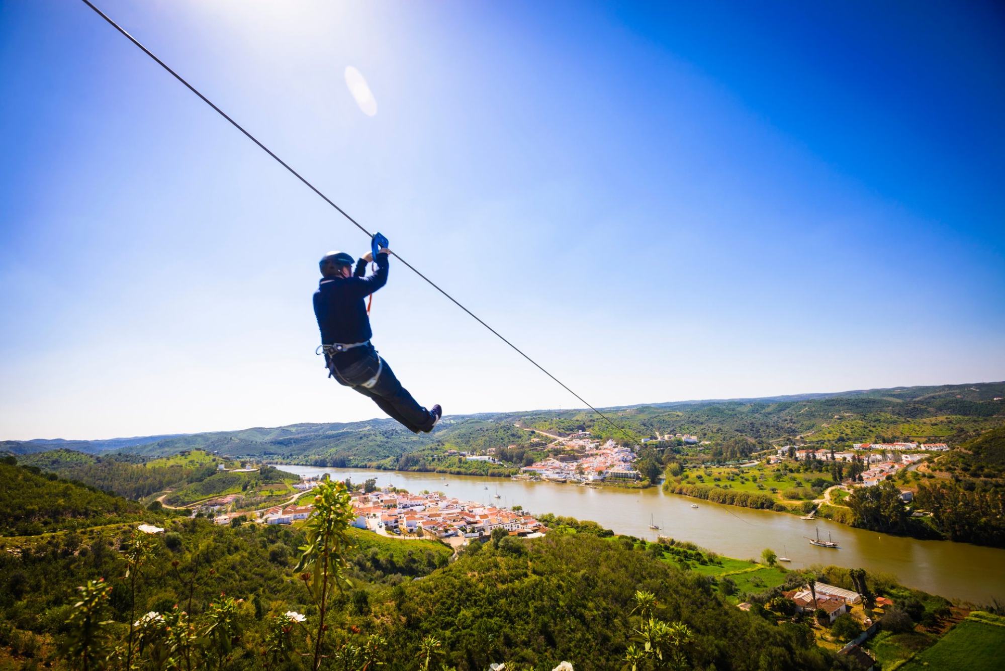
There is a one-hour time difference between the two Iberian nations so you’ll arrive in Alcoutim, Portugal, 59 minutes before you set off from the Spanish city of Sanlúcar de Guadiana. And if you’re wondering how to negotiate passport procedures, fear not; both countries are members of the free cross-border travel region known as the Schengen Area.
At dusk, tangerine skies offer an attractive canvas – fishing boats provide distinctive silhouettes.

Mountains
The remote Río Don Guillermo immigration post is the easiest connection to use when travelling between the gorgeous Torres del Paine National Park, in Chile, and Argentina’s Los Glaciares National Park.
There are too many Alpine crossing points between Switzerland and Germany, France, Italy, Austria and Slovenia to cover here so let’s head east, to the Tatra Mountains, which are part of the Carpathian range.
The Poland-Slovakia border is a high-altitude region of lakes and jagged peaks loved by skiers, mountaineers and hikers. Zakopane, on the Polish side, is known as the winter capital of Poland and over in Slovakia, Zdiar is an excellent base for a walking holiday.

No article on scenic frontiers should neglect to mention the Khunjerab Pass (4,706 metres), the loftiest land border in the world and where you’ll find the world’s highest ATM. (Who is responsible for replenishing the cash and how often?)
Waterfalls
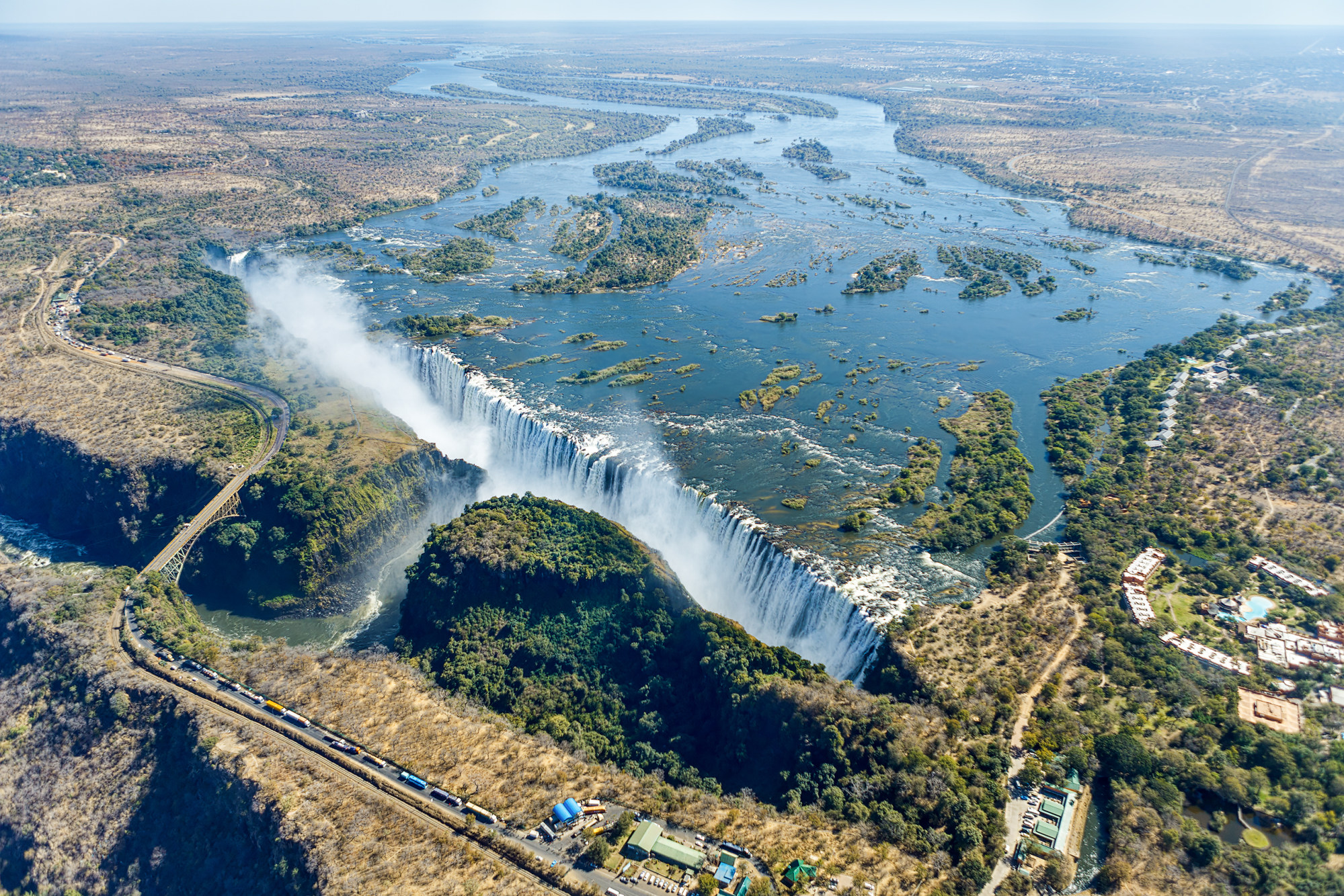
The Victoria Falls Bridge, which spans the Zambezi River, has customs and immigration facilities at each end.
Taller than Niagara and wider than the cataracts at Victoria, Iguazu Falls boasts three international border crossings. The so-called Triple Frontier separates Argentina, Paraguay and Brazil at the point where the Iguazu and Parana rivers converge.
Also here are two Unesco-designated national parks and, although one is in Argentina and the other in Brazil, they are part of the same ecosystem.
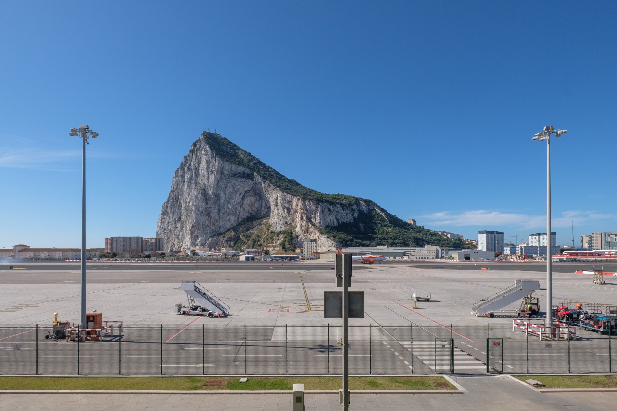
From rivers to runways: follow Winston Churchill Avenue north and, after crossing Gibraltar Airport runway, you’re only a few steps from the border with Spain. From almost any standpoint in the British Overseas Territory, the enormous slab of Jurassic limestone known as the Rock looms.
Head to the top by cable car for views of two continents and two oceans. The Spanish region of Andalusia unfurls like a giant map in one direction, the hazy outline of Morocco is visible in the other.
Renowned for its sandy white beaches and cobalt blue waters, Lake Tanganyika is the world’s second deepest, after Russia’s Lake Baikal, and fifth largest. The Central African body of water is surrounded by Burundi, Democratic Republic of the Congo, Tanzania and Zambia – no other lake is shared by more countries.
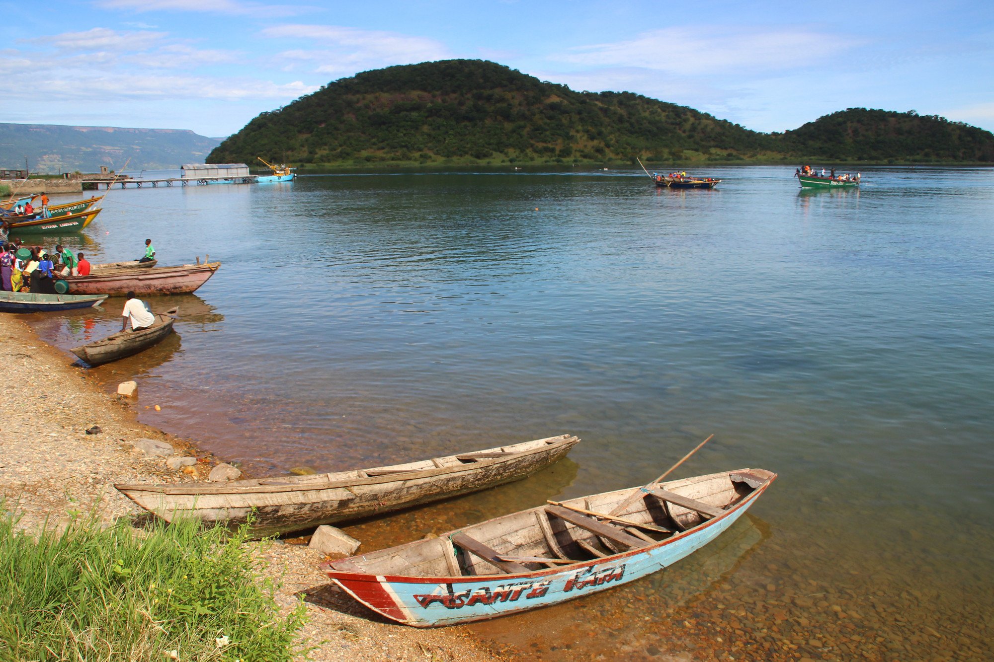
There is plenty of aquatic activity, from rickety fishing boats to wooden barges, cargo ships and passenger ferries. One tireless vessel, the MV Liemba, which runs from Kigoma, Tanzania, to Mpulungu in Zambia, appeared in the classic 1951 film The African Queen.
Safari-goers complete immigration formalities at either Namanga or Isebania, and on days when the lines are long, probably wish they could copy the animals they’ve come to see and cross the open savannah and endless grasslands unhindered.
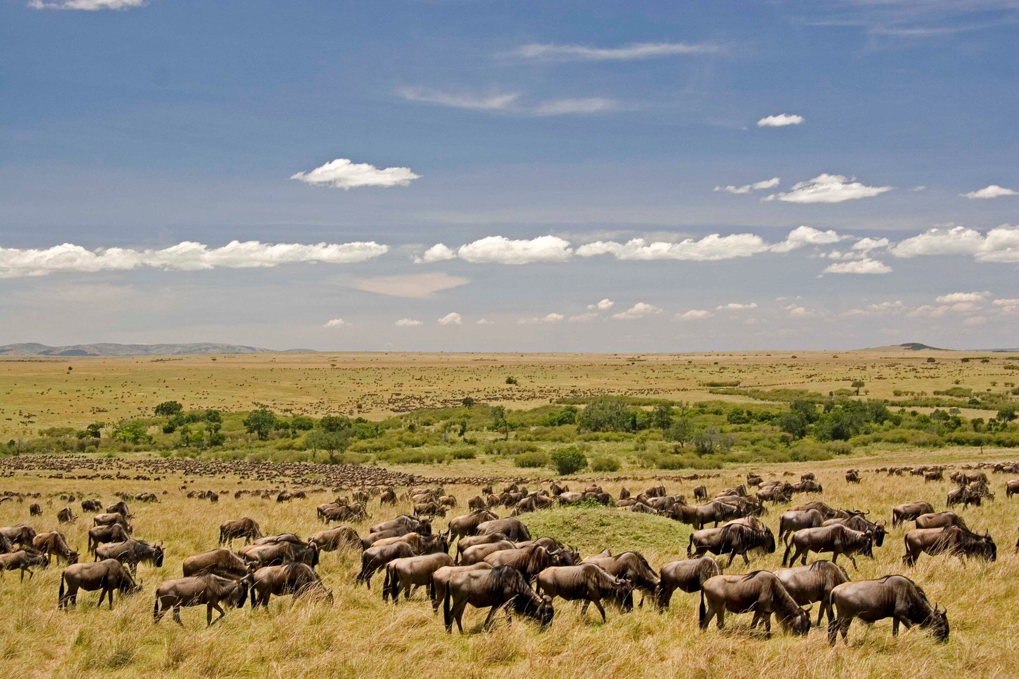
After all, 2 million wildebeest, zebra and gazelle migrate between Kenya and Tanzania annually. No one asks them how long they intend to stay, the purpose of their visit or whether they have anything to declare.

