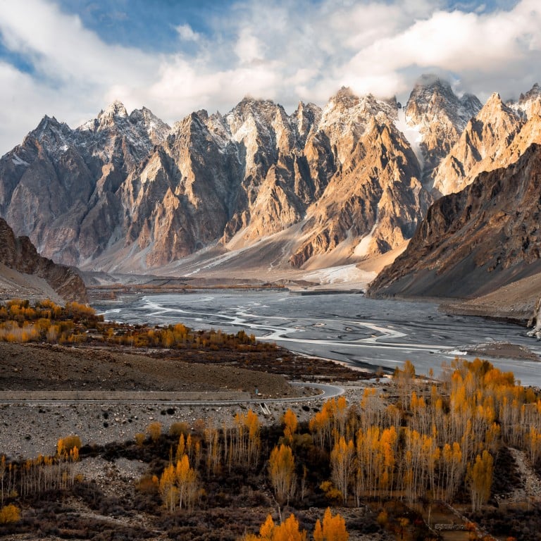
Pakistan’s Karakoram Highway – ups and downs of a trip on ‘8th wonder of the world’: stunning views, welcoming people, but landslides, altitude sickness are hazards
- The 1,300km-long road connects China and Pakistan via the heavenly Hunza Valley, where women’s rights are protected and literacy is high – as is nearby peak K2
- Dizzying scenery abounds, but, as the road’s name – meaning ‘crumbling rock’ – suggests, landslides are common. Then there’s Pakistan’s political instability
Often portrayed in the media as a politically volatile nuclear power, Pakistan is home to some of the most genuinely hospitable people on Earth.
It’s a country of parched, dusty landscapes that give way to a beautiful land of snow-capped mountains, massive glaciers and azure lakes that few outsiders could find on a map.
The KKH is best experienced in spring or autumn, when the weather is obliging and visibility is excellent.
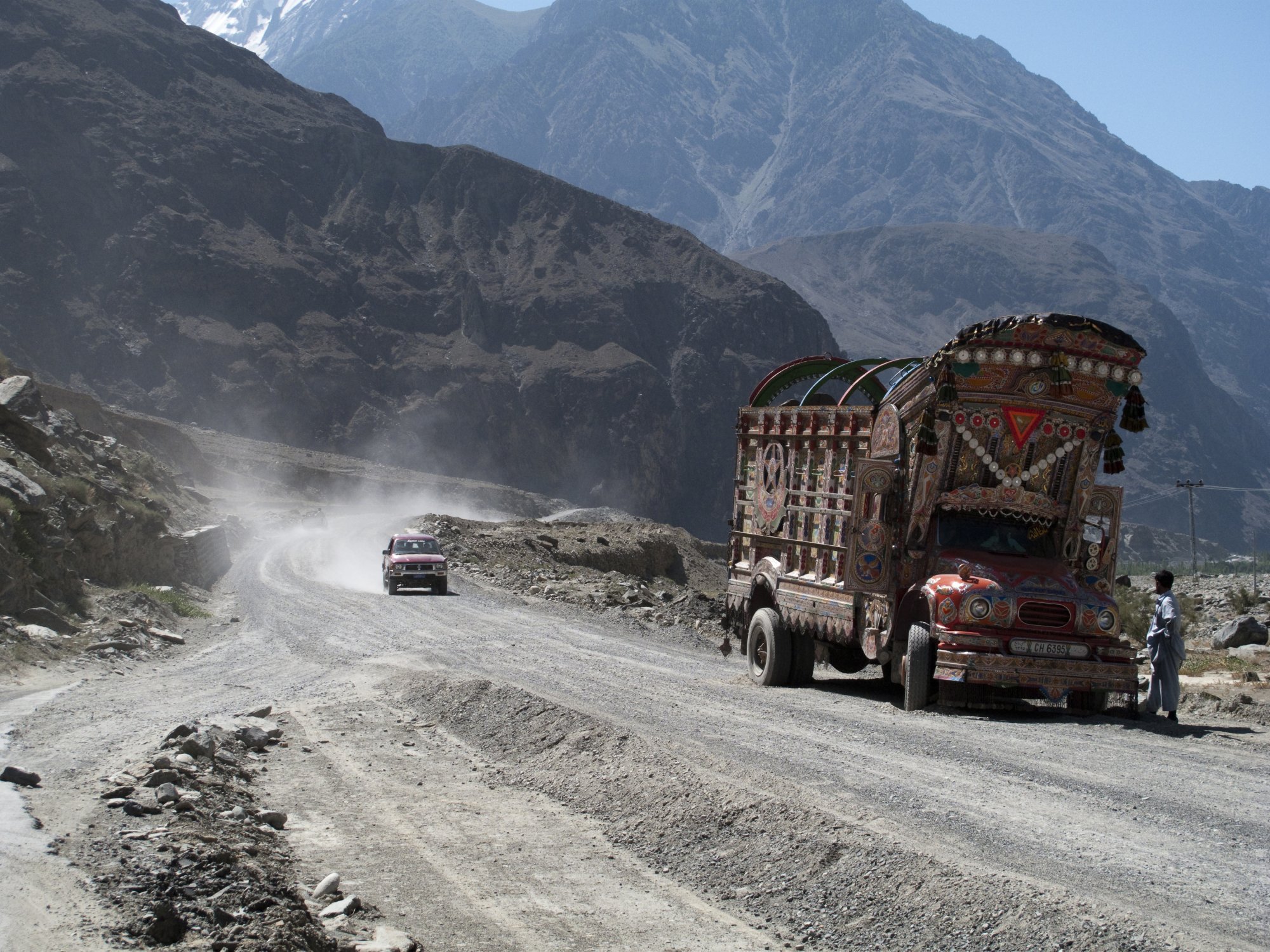
A Sino-Pakistan joint venture, the road was blasted out of mountains where in many places only donkey tracks had existed. Dubbed the eighth wonder of the world, the engineering marvel is known as the Friendship Highway in China.
The most inspiring stage of what has been described as the Mother of All Road Trips begins near Gilgit. Here, farmers tend terraces of wheat, barley and potato in stone villages nestled beneath perpendicular Pakistani peaks, and apple, peach and apricot orchards flourish in the sunshine.
It’s certainly scenic, but doesn’t prepare you for the astonishing vistas that await.
The Hunza Valley lies close to the Chinese border, but was cut off from the world until the KKH was carved out of the mountains. Cobalt skies, the scent of poplar trees and glimpses of Mount Rakaposhi (7,788 metres, or 21,550 feet) and Ultar Peak (7,388 metres) confirm you’ve arrived at Heaven on Earth.
Where is the world’s highest road? The most famous? The most dangerous?
High-altitude Hunza is mountaineering territory, and while the professionals gear up for assaults on K2 and Nanga Parbat, there are plenty of hikes for the less adventurous.
Eight-hundred-year-old Baltit Fort surveys all before it from a ledge high above the town of Karimabad. The Unesco-designated stronghold was once the residence of ruthless Hunza highwaymen who plundered Silk Route convoys.
Times change, though, and tourists who come to Hunza for the mind-bending scenery end up staying because of the incredible hospitality of the people.
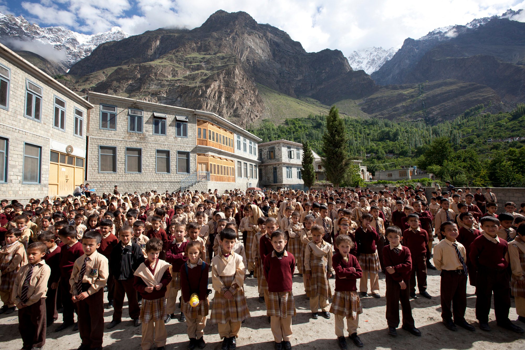
Hitchhikers won’t have to wait long for a lift, children greet visitors with gap-toothed grins and female farmers taking a break from the fields beckon you over to drink tea. They’ll be wearing smiles rather than veils and will happily pose for photos.
Hunza is known for being the most liberal region in Pakistan. Ismailism, a moderate sect of Islam, promotes tolerance and women’s rights. Nearly every child attends school – regardless of gender – and in 2016, Al Jazeera reported that Hunza had a literacy rate of around 95 per cent, making it the most literate district in the entire country.
Nationwide, only 20 per cent of Pakistani women participate in the formal workforce, one of the lowest rates in the world. In the Hunza Valley, by comparison, women are busy running restaurants and shops, and work as teachers, mechanics and plumbers.
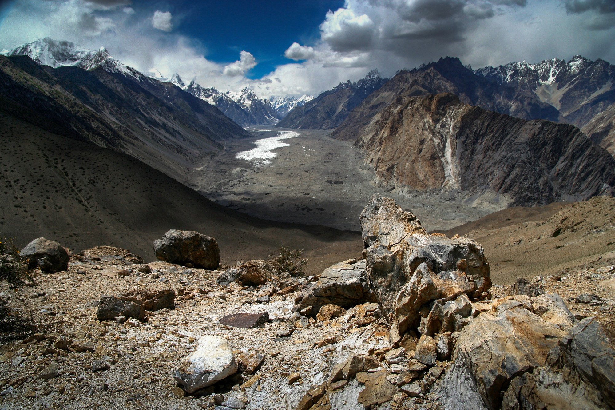
Bisecting the razor-sharp mountains, the KKH climbs steadily onwards to Upper Hunza. Be sure to pause near the village of Passu, where the mesmerising Batura Glacier extends to the edge of the highway.
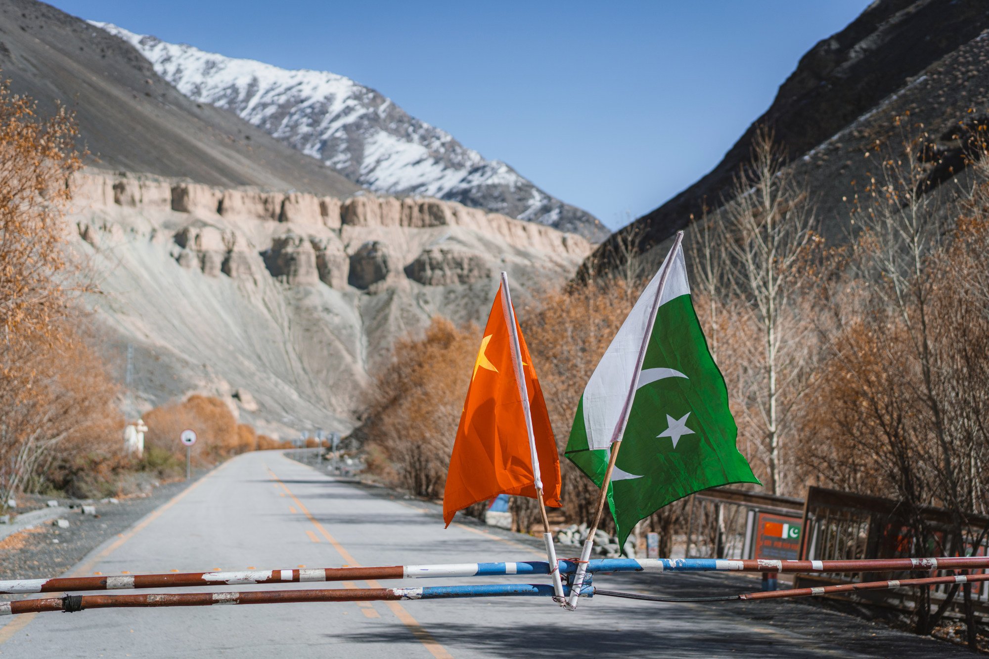
The final leg, to the border with China, involves negotiating the 4,730-metre Khunjerab Pass, the highest paved international frontier in the world. If you plan to continue into China, bear in mind the crossing is closed at weekends and from November to March.
Falling rocks
Impressive though it is, the KKH requires constant maintenance. The steep mountainsides consist of brittle rock prone to landslides (karakoram means “crumbling rock” in Turkish). During construction, about 1,000 workers lost their lives – one for every 1.5km of road.
And the loss of life continues. Since the KKH was completed, a further 1,000 deaths have been reported, many because of driver error. Overturned wrecks in ravines serve as a stark reminder of how dangerous some sections of the road are.
In July last year, six people were killed and 17 injured when a bus carrying tourists plunged into a deep gorge. In the same month, torrential rain battered northern Pakistan, causing severe flooding and landslides that left hundreds stranded.
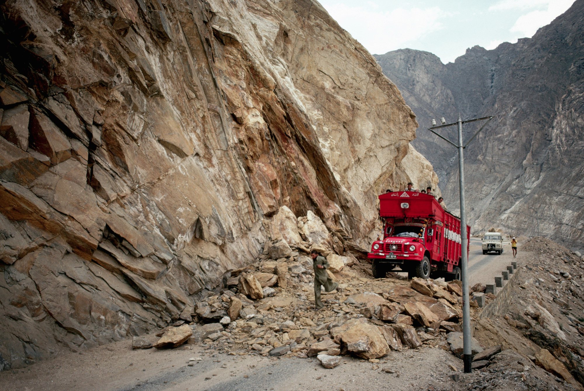
Worse still was a landslide in 2010 that obliterated several villages, blocked the flow of the Hunza River, and obstructed the highway for years. Pakistan’s neighbour built five “China-Pakistan Friendship Tunnels” to get traffic moving again.
Most travellers gradually acclimatise as they head along the KKH but the air is thin, particularly at the Khunjerab Pass, and over-exerting is a no-no.
Splitting headaches, nausea and dizziness caused by altitude sickness can turn the journey into an uncomfortable ordeal – locals suggest chewing dried apricots to combat any lingering effects.
The world’s most photo-worthy border crossings and a transfrontier zip line
An upsurge in tourism on the KKH and in the Hunza Valley has brought benefits and burdens.
The influx of free-spending visitors contributes to socio-economic progress and creates job opportunities for Hunzakuts.
But increasing numbers of sightseers means more damage to fragile Himalayan hiking trails and new roads act as drivers of deforestation which, combined with the relentless development of tourism-related infrastructure, disturb and destroy wildlife habitat.
No obstacle too big: China builds US$275 million tunnel through Pakistan mountain for new highway to replace the old Silk Road
For an isolated population that not long ago had limited interaction with lowland Pakistanis and foreign travellers, there are issues of cultural erosion that can lead to a breakdown in community ties.
In addition, dependence on seasonal sources of revenue can result in vulnerability when cash flow ceases, even temporarily.
Lastly, traffic congestion on the KKH causes pollution and littering and accelerates wear and tear of the highway.
Political instability
In August 2023, the Hong Kong Security Bureau updated its outbound travel alert for Pakistan to a red “significant threat” level due to political instability. For the time being, those intending to visit are advised to “adjust their travel plans and avoid non-essential travel”.

