Hong Kong Observatory issues No 3 storm warning as Mawar edges closer
Storm has made landfall east of city at Shanwei in Guangdong province
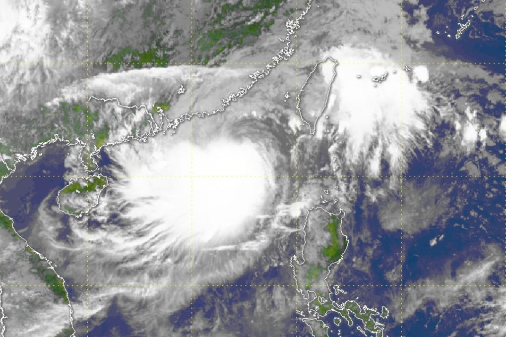
The Hong Kong Observatory issued its No 3 warning signal at 10.40pm on Sunday as tropical storm Mawar edged closer to the city.
Mawar, which had weakened from a severe tropical storm into a tropical storm, was estimated to be about 200km east-northeast of Hong Kong and was forecast to move northwest to west-northwest at about 12km/h, the Observatory said.
The Observatory said Mawar had made landfall near Shanwei about 9.30pm on Sunday. It will move inland and weaken gradually, but will still move closer to Hong Kong. Winds will turn to strong southwesterlies over parts of the territory.
And the signal No 3 will be in effect on Monday morning. Unless Mawar moves even closer to the territory, the chance that the No 8 gale or storm signal will be issued is not high.
The No 3 signal indicates winds with a sustained speed of 41-62km/h are expected, with gusts possibly exceeding 110km/h.
With Mawar moving closer, its rainbands were set to affect Hong Kong and the Pearl River Delta. Heavy rain and squalls were forecast for early Monday, but the wet weather was expected to ease off later in the day.
Temperatures were forecast to range from 25 to 30 degrees Celsius.