China the ‘natural suspect’ behind military upgrades on Myanmar islands near India
- Myanmar doesn’t have the financial or technical capabilities to carry out the military modernisation seen on the Coco Islands, analysts say
- China has in recent years acquired commercial and military footholds around the Indian Ocean, and maintains relations with Myanmar despite the coup
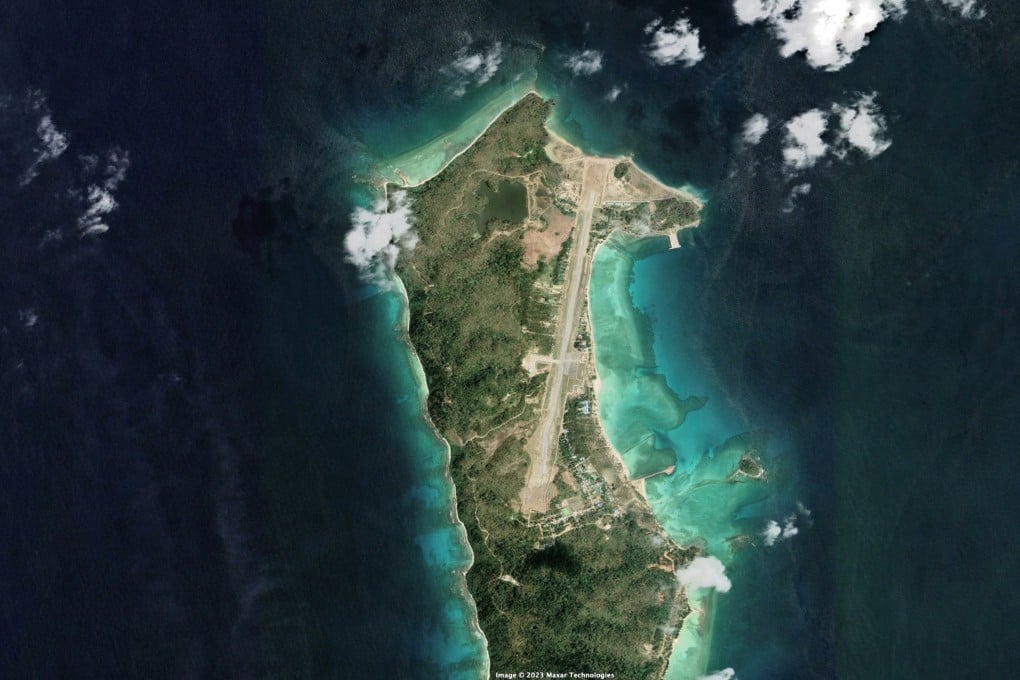
The images show that Myanmar’s islands have over the years experienced “a steady makeover, with telltale signs of military modernisation and facilities to support aircraft”, said the report titled “Is Myanmar building a spy base on Great Coco Island?”.

China on Monday hit back at the report, with the foreign ministry in Beijing calling it “sheer nonsense” in response to a question by Bloomberg on WeChat.
A spokesman for Myanmar’s ruling State Administration Council earlier called the allegation that China was building the facility on the islands absurd.
The report said a major extension of the island’s runway in the past decade was among the most visible changes in the area. The satellite pictures, taken in January by US space technology firm Maxar Technologies, also showed new hangars, a radar station and a large pier, while a causeway appeared to be under construction in the southern part of Great Coco where 1,500 people live.
Troy Lee-Brown, a research fellow at the University of Western Australia Defence and Security Institute, said the images suggested “a fairly significant build-up in infrastructure development” on the archipelago from “what used to be a pretty rudimentary radar station”.